Nikita Yingqian Cai
Maritime Silk Road
In 1988, UNESCO launched a ten-year program, entitled “Integral Study of the Silk Roads: Roads of Dialogue.” This cross-national study viewed the Silk Road as the common heritage of East and West, which fostered cultural exchange in the Eurasian Continent. This program's definition of the Silk Road was primarily based on the concept of die Seidenstrasse, an interlocking set of overland routes that connected the western Han dynasty and the Roman Empire, proposed by Ferdinand von Richthofen (1833-1905), a German geographer and founder of modern geography. In September 1868, von Richthofen arrived in Shanghai on a steamship with the ambition to explore coal resources in inland China. In that quest, he traveled across the Gobi Desert seven times in four years. His map centered on Inner Asia, with China, the Mediterranean world, and even the Indian Subcontinent on the periphery of Eurasia. He understood the importance of the spice routes across the Indian Ocean and South China Sea, but for the Austro-Hungarian Empire, oceans were not a focal point of the imperialist competition for resources.
In 2007, Roderich Ptak published Die Maritime Seidenstrasse (The Maritime Silk Road ). He describes maritime navigation and trade in Asian seas prior to the sixteenth century and offers further insight into the indigenous peoples inhabiting the endless coastline and maritime worlds of the East China Sea, the South China Sea, the Sulu Sea, Java, the Strait of Malacca, the Bay of Bengal, the Arabian Sea, and even East Africa. During this time, trade between Asia and Europe was limited, but in the Age of Discovery, American silver extracted by Spanish colonizers was shipped to Asia (primarily China), and Asian products were sold all over the world as luxury goods. When the Europeans, who were more accustomed to navigating the Mediterranean Sea, arrived in Asian waters, they often needed to rely on the navigation skills and knowledge of local sailors. The monsoon was crucially important; in seas where the North Star was not visible, sailors navigated by identifying cloud forms and waves and observing the ocean surface and the behaviors of birds and animals near islands. Pre-modern rulers along the Maritime Silk Road had different conceptions of territory than sovereign states; sailors, merchants, and fishermen from different areas sailed and fished on the open seas, negotiating and trading with different groups.
With the advent of post-colonial deconstruction, the Maritime Silk Road in the twenty-first century became the focus of nation-building, politicization, and aestheticization efforts, such as China's New Maritime Silk Road project in 2013 and India's Project Mausam in 2014. Many Maritime Silk Road Museums and sites have been constructed. Conversely, the Maritime Silk Road could be envisioned as the interweaving of different worlds, which involve tributary systems, imperial trade, contemporary globalization, and different belief systems; Kunlun slaves, Persians, pirates, sailors, refugees, and boat people; Arabic, Sanskrit, Malay, and various pidgin languages; ports, islands, shipping, tropical climates, and plantations; spices, seafood, silk, porcelain, minerals, and opium… In this sense, the Maritime Silk Road has no center and no beginning.
(Translated by Bridget Noetzel )

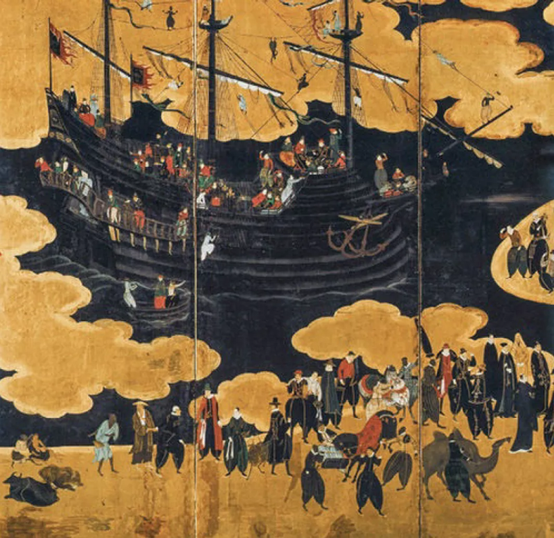
The "Nanban" merchants depicted on Japanese folding screens in the 16th century were Portuguese merchants who regularly came to the coastal areas of Japan to trade. The Japanese in the Azuchi-Momoyama period were keen to paint Nanban ships, various people and goods on folding screens.

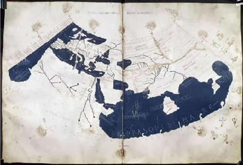
Ptolemy's world map in the manuscript of Geography published in the 15th century. It represents the largest geographic range recognized by the Greco-Roman world in the classical times, and also reflects the communication between the Greco-Roman world and the Indian Ocean world.

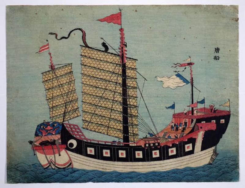
The "Tang Boat" depicted in a Nagasaki print is a Chinese merchant ship. China and Japan had maintained long-term trade relations, and Nagasaki was an important port where Chinese merchant ships call.
The above three pictures are adopted from Roderich Ptak, Die Maritime Seidenstrasse, Post Wave Publishing | China Friendship Publishing, 2019